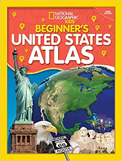
MIDDLE GRADE BROWSEABLE NONFICTION : Beginner's United States Atlas 3rd Edition & Beginner's World Atlas 4th Edition by National Geographic Kids
ABOUT THE BOOK
The updated third edition of this popular atlas introduces young readers
to the wonders of all of America's states and territories, with maps,
fun facts, geographical features, and more.This fun, easy-to-use atlas
takes kids on a journey around the U.S. to showcase what's unique about
each state and territory. Every profile starts with a colorful map and a
lively essay and includes capital cities; population; important land
and water features; state birds, flowers, and flags; and more. It's all
packaged in a bigger format, with a refreshed design, and bold, bright
photos and illustrations. National Geographic--known for its
authoritative data, expert cartography, and beautiful photography--is
the number one provider of atlases for people of all ages.
REVIEW
This atlas introduces young readers to maps using basic geographic principles. The introduction explains how the book is organized as well as what maps are and the features included with each map. Generic information about the country and it's capital is shared before the five regions into which the U.S. is divided are introduced. The majority of the book shares information about each of the fifty states and its territories. Each state has a two page spread that shows a map and map key. Additional information about the flag, state flower, state bird, and unique facts are included. Several striking photographs accompany each spread. As with so much that they do, National Geographic has done an excellent job in terms of information and presentation. For young geography lovers, this atlas is a great way to learn about maps and about some of the things that make the different states unique.
ABOUT THE BOOK
Our world is constantly changing and this refreshed atlas from the
map experts at National Geographic captures the state of the planet with
colorful maps, easy-to-grasp stats, and lots of fun facts--the perfect
reference for young kids and students.
Learn all about the people, places, animals, and environments of our world in the fourth edition of this engaging atlas. It's got a fresh, kid-friendly design; fun, lively photos; and all the latest, greatest geographic and political information that make this such a valuable resource. It's the perfect reference for kids to learn about lands close to home or oceans away--ideal for classroom use, homework help, and armchair exploration.
Learn all about the people, places, animals, and environments of our world in the fourth edition of this engaging atlas. It's got a fresh, kid-friendly design; fun, lively photos; and all the latest, greatest geographic and political information that make this such a valuable resource. It's the perfect reference for kids to learn about lands close to home or oceans away--ideal for classroom use, homework help, and armchair exploration.
REVIEW
This atlas provides a solid introduction to maps and how they are created. With stunning photographs and fascinating information, this atlas can provide hours of browsing pleasure for those with a geographic bent. In addition to showing maps of the world as a whole in both physical and political formats, the book takes a closer look at each of the seven continents. With its gorgeous photographs, solid physical and political maps combined with brief text describing elements of each continent such as regions, water, climate, plants, animals, countries, cities, people, and languages, this atlas gives a great beginning introduction to the world for young readers.


Comments
Post a Comment